Набор данных GEE - ERA5 - Ежедневная сводка по земле - Набор данных реанализа климата ЕЦСПП
Введение
Примечание (19 апреля 2024 г.): ЕЦСПП, поскольку усилия по модернизации хранилища климатических данных Коперника повлияли Производство набора данных может быть прервано. Провайдер не уточнил планируемую дату завершения, подробности можно найти на форуме пользователей. ERA5-Land — это набор данных для повторного анализа, который обеспечивает последовательное представление об эволюции переменных земель за несколько десятилетий с более высоким разрешением, чем ERA5. Земля ERA5 проходит повтор ECMWF ERA5 Создано на основе сухопутного компонента реанализа климата. Реанализ использует законы физики для объединения данных модели с наблюдениями со всего мира для формирования глобально полного и согласованного набора данных. Реанализ дает данные за несколько десятилетий назад и точно описывает климат прошлого. Набор данных включает в себя CDS Все доступно на 50 индивидуальныйпеременная,да ECMWF ERA5 Ежедневное суммирование почасовых данных о суше, включая как движущиеся, так и неподвижные полосы. Полосы трафика формируются путем сбора данных за первый час следующего дня, которые содержат сумму предыдущего дня, а полосы нетрафика формируются путем усреднения данных за все часы дня. Использование полосы трафика"_sum " аннотация идентификатора, этот подход отличается от ежедневных данных, генерируемых хранилищем климатических данных Copernicus, которое также усредняет полосы стока. Ежедневные итоги рассчитываются заранее, чтобы облегчить работу многих приложений, требующих быстрого и легкого доступа к данным.
Совокупные ежедневные данные ERA5-land доступны по адресу: 1950 Данные в реальном времени от одного года до трех месяцев. Для получения дополнительной информации посетите хранилище климатических данных Copernicus. Полосы осадков и других потоков (накопления) иногда показывают отрицательные значения, что физически не обосновано. Эта проблема связана с GRIB Формат обусловлен способом сохранения данных: он упрощает или "Пакет " на меньшее и менее точное число, что может привести к ошибкам. Эти ошибки становятся более серьезными, когда данные сильно различаются. По этой причине, когда мы смотрим на данные за полный день, чтобы рассчитать общее количество осадков за день, иногда самое большое количество осадков, зарегистрированное за один раз, может быть больше, чем общее количество осадков, измеренное в течение дня. Чтобы узнать больше, см.: "Почему иногда выпадают небольшие отрицательные кумулятивные осадки??Climate Data Store
Описание набора данных
Dataset Availability
1950-01-02T00:00:00 -
Dataset Provider
Daily Aggregates: Google and Copernicus Climate Data Store
Collection Snippet
Copied
ee.ImageCollection("ECMWF/ERA5_LAND/DAILY_AGGR")
пространственная информация
Resolution
11132 meters
Bands Table
Name | Description | Units |
|---|---|---|
dewpoint_temperature_2m | Temperature to which the air, at 2 meters above the surface of the Earth, would have to be cooled for saturation to occur. It is a measure of the humidity of the air. Combined with temperature and pressure, it can be used to calculate the relative humidity. 2m dew point temperature is calculated by interpolating between the lowest model level and the Earth's surface, taking account of the atmospheric conditions. | K |
temperature_2m | Temperature of air at 2m above the surface of land, sea or in-land waters. 2m temperature is calculated by interpolating between the lowest model level and the Earth's surface, taking account of the atmospheric conditions. | K |
skin_temperature | Temperature of the surface of the Earth. The skin temperature is the theoretical temperature that is required to satisfy the surface energy balance. It represents the temperature of the uppermost surface layer, which has no heat capacity and so can respond instantaneously to changes in surface fluxes. Skin temperature is calculated differently over land and sea. | K |
soil_temperature_level_1 | Temperature of the soil in layer 1 (0 - 7 cm) of the ECMWF Integrated Forecasting System. The surface is at 0 cm. Soil temperature is set at the middle of each layer, and heat transfer is calculated at the interfaces between them. It is assumed that there is no heat transfer out of the bottom of the lowest layer. | K |
soil_temperature_level_2 | Temperature of the soil in layer 2 (7-28 cm) of the ECMWF Integrated Forecasting System. | K |
soil_temperature_level_3 | Temperature of the soil in layer 3 (28-100 cm) of the ECMWF Integrated Forecasting System. | K |
soil_temperature_level_4 | Temperature of the soil in layer 4 (100-289 cm) of the ECMWF Integrated Forecasting System. | K |
lake_bottom_temperature | Temperature of water at the bottom of inland water bodies (lakes, reservoirs, rivers) and coastal waters. ECMWF implemented a lake model in May 2015 to represent the water temperature and lake ice of all the world's major inland water bodies in the Integrated Forecasting System. The model keeps lake depth and surface area (or fractional cover) constant in time. | K |
lake_ice_depth | The thickness of ice on inland water bodies (lakes, reservoirs and rivers) and coastal waters. The ECMWF Integrated Forecasting System (IFS) represents the formation and melting of ice on inland water bodies (lakes, reservoirs and rivers) and coastal water. A single ice layer is represented. This parameter is the thickness of that ice layer. | m |
lake_ice_temperature | The temperature of the uppermost surface of ice on inland water bodies (lakes, reservoirs, rivers) and coastal waters. The ECMWF Integrated Forecasting System represents the formation and melting of ice on lakes. A single ice layer is represented. | K |
lake_mix_layer_depth | The thickness of the upper most layer of an inland water body (lake, reservoirs, and rivers) or coastal waters that is well mixed and has a near constant temperature with depth (uniform distribution of temperature). The ECMWF Integrated Forecasting System represents inland water bodies with two layers in the vertical, the mixed layer above and the thermocline below. Thermoclines upper boundary is located at the mixed layer bottom, and the lower boundary at the lake bottom. Mixing within the mixed layer can occur when the density of the surface (and near-surface) water is greater than that of the water below. Mixing can also occur through the action of wind on the surface of the lake. | m |
lake_mix_layer_temperature | The temperature of the upper most layer of inland water bodies (lakes, reservoirs and rivers) or coastal waters) that is well mixed. The ECMWF Integrated Forecasting System represents inland water bodies with two layers in the vertical, the mixed layer above and the thermocline below. Thermoclines upper boundary is located at the mixed layer bottom, and the lower boundary at the lake bottom. Mixing within the mixed layer can occur when the density of the surface (and near-surface) water is greater than that of the water below. Mixing can also occur through the action of wind on the surface of the lake. | K |
lake_shape_factor | This parameter describes the way that temperature changes with depth in the thermocline layer of inland water bodies (lakes, reservoirs and rivers) and coastal waters. It is used to calculate the lake bottom temperature and other lake-related parameters. The ECMWF Integrated Forecasting System represents inland and coastal water bodies with two layers in the vertical, the mixed layer above and the thermocline below where temperature changes with depth. | |
lake_total_layer_temperature | The mean temperature of total water column in inland water bodies (lakes, reservoirs and rivers) and coastal waters. The ECMWF Integrated Forecasting System represents inland water bodies with two layers in the vertical, the mixed layer above and the thermocline below where temperature changes with depth. This parameter is the mean over the two layers. | K |
snow_albedo | It is defined as the fraction of solar (shortwave) radiation reflected by the snow, across the solar spectrum, for both direct and diffuse radiation. It is a measure of the reflectivity of the snow covered grid cells. Values vary between 0 and 1. Typically, snow and ice have high reflectivity with albedo values of 0.8 and above. | |
snow_cover | It represents the fraction (0-1) of the cell / grid-box occupied by snow (similar to the cloud cover fields of ERA5). | % |
snow_density | Mass of snow per cubic meter in the snow layer. The ECMWF Integrated Forecast System (IFS) model represents snow as a single additional layer over the uppermost soil level. The snow may cover all or part of the grid box. | kg/m^3 |
snow_depth | Instantaneous grib-box average of the snow thickness on the ground (excluding snow on canopy). | m |
snow_depth_water_equivalent | Depth of snow from the snow-covered area of a grid box. Its units are meters of water equivalent, so it is the depth the water would have if the snow melted and was spread evenly over the whole grid box. The ECMWF Integrated Forecast System represents snow as a single additional layer over the uppermost soil level. The snow may cover all or part of the grid box. | m of water equivalent |
snowfall_sum | Accumulated total snow that has fallen to the Earth's surface. It consists of snow due to the large-scale atmospheric flow (horizontal scales greater than around a few hundred meters) and convection where smaller scale areas (around 5km to a few hundred kilometers) of warm air rise. If snow has melted during the period over which this variable was accumulated, then it will be higher than the snow depth. This variable is the total amount of water accumulated from the beginning of the forecast time to the end of the forecast step. The units given measure the depth the water would have if the snow melted and was spread evenly over the grid box. Care should be taken when comparing model variables with observations, because observations are often local to a particular point in space and time, rather than representing averages over a model grid box and model time step. | m of water equivalent |
snowmelt_sum | Melting of snow averaged over the grid box (to find melt over snow, divide by snow fraction). This variable is accumulated from the beginning of the forecast time to the end of the forecast step. | m of water equivalent |
temperature_of_snow_layer | This variable gives the temperature of the snow layer from the ground to the snow-air interface. The ECMWF Integrated Forecast System (IFS) model represents snow as a single additional layer over the uppermost soil level. The snow may cover all or part of the grid box. | K |
skin_reservoir_content | Amount of water in the vegetation canopy and/or in a thin layer on the soil. It represents the amount of rain intercepted by foliage, and water from dew. The maximum amount of 'skin reservoir content' a grid box can hold depends on the type of vegetation, and may be zero. Water leaves the 'skin reservoir' by evaporation. | m of water equivalent |
volumetric_soil_water_layer_1 | Volume of water in soil layer 1 (0 - 7 cm) of the ECMWF Integrated Forecasting System. The surface is at 0 cm. The volumetric soil water is associated with the soil texture (or classification), soil depth, and the underlying groundwater level. | Volume fraction |
volumetric_soil_water_layer_2 | Volume of water in soil layer 2 (7 -28 cm) of the ECMWF Integrated Forecasting System. | Volume fraction |
volumetric_soil_water_layer_3 | Volume of water in soil layer 3 (28-100 cm) of the ECMWF Integrated Forecasting System. | Volume fraction |
volumetric_soil_water_layer_4 | Volume of water in soil layer 4 (100-289 cm) of the ECMWF Integrated Forecasting System. | Volume fraction |
forecast_albedo | Is a measure of the reflectivity of the Earth's surface. It is the fraction of solar (shortwave) radiation reflected by Earth's surface, across the solar spectrum, for both direct and diffuse radiation. Values are between 0 and 1. Typically, snow and ice have high reflectivity with albedo values of 0.8 and above, land has intermediate values between about 0.1 and 0.4 and the ocean has low values of 0.1 or less. Radiation from the Sun (solar, or shortwave, radiation) is partly reflected back to space by clouds and particles in the atmosphere (aerosols) and some of it is absorbed. The rest is incident on the Earth's surface, where some of it is reflected. The portion that is reflected by the Earth's surface depends on the albedo. In the ECMWF Integrated Forecasting System (IFS), a climatological background albedo (observed values averaged over a period of several years) is used, modified by the model over water, ice and snow. Albedo is often shown as a percentage (%). | |
surface_latent_heat_flux_sum | Exchange of latent heat with the surface through turbulent diffusion. This variables is accumulated from the beginning of the forecast time to the end of the forecast step. By model convention, downward fluxes are positive. | J/m^2 |
surface_net_solar_radiation_sum | Amount of solar radiation (also known as shortwave radiation) reaching the surface of the Earth (both direct and diffuse) minus the amount reflected by the Earth's surface (which is governed by the albedo). Radiation from the Sun (solar, or shortwave, radiation) is partly reflected back to space by clouds and particles in the atmosphere (aerosols) and some of it is absorbed. The rest is incident on the Earth's surface, where some of it is reflected. The difference between downward and reflected solar radiation is the surface net solar radiation. This variable is accumulated from the beginning of the forecast time to the end of the forecast step. The units are joules per square meter (J m-2). To convert to watts per square meter (W m-2), the accumulated values should be divided by the accumulation period expressed in seconds. The ECMWF convention for vertical fluxes is positive downwards. | J/m^2 |
surface_net_thermal_radiation_sum | Net thermal radiation at the surface. Accumulated field from the beginning of the forecast time to the end of the forecast step. By model convention downward fluxes are positive. | J/m^2 |
surface_sensible_heat_flux_sum | Transfer of heat between the Earth's surface and the atmosphere through the effects of turbulent air motion (but excluding any heat transfer resulting from condensation or evaporation). The magnitude of the sensible heat flux is governed by the difference in temperature between the surface and the overlying atmosphere, wind speed and the surface roughness. For example, cold air overlying a warm surface would produce a sensible heat flux from the land (or ocean) into the atmosphere. This is a single level variable and it is accumulated from the beginning of the forecast time to the end of the forecast step. The units are joules per square meter (J m-2). To convert to watts per square meter (W m-2), the accumulated values should be divided by the accumulation period expressed in seconds. The ECMWF convention for vertical fluxes is positive downwards. | J/m^2 |
surface_solar_radiation_downwards_sum | Amount of solar radiation (also known as shortwave radiation) reaching the surface of the Earth. This variable comprises both direct and diffuse solar radiation. Radiation from the Sun (solar, or shortwave, radiation) is partly reflected back to space by clouds and particles in the atmosphere (aerosols) and some of it is absorbed. The rest is incident on the Earth's surface (represented by this variable). To a reasonably good approximation, this variable is the model equivalent of what would be measured by a pyranometer (an instrument used for measuring solar radiation) at the surface. However, care should be taken when comparing model variables with observations, because observations are often local to a particular point in space and time, rather than representing averages over a model grid box and model time step. This variable is accumulated from the beginning of the forecast time to the end of the forecast step. The units are joules per square meter (J m-2). To convert to watts per square meter (W m-2), the accumulated values should be divided by the accumulation period expressed in seconds. The ECMWF convention for vertical fluxes is positive downwards. | J/m^2 |
surface_thermal_radiation_downwards_sum | Amount of thermal (also known as longwave or terrestrial) radiation emitted by the atmosphere and clouds that reaches the Earth's surface. The surface of the Earth emits thermal radiation, some of which is absorbed by the atmosphere and clouds. The atmosphere and clouds likewise emit thermal radiation in all directions, some of which reaches the surface (represented by this variable). This variable is accumulated from the beginning of the forecast time to the end of the forecast step. The units are joules per square meter (J m-2). To convert to watts per square meter (W m-2), the accumulated values should be divided by the accumulation period expressed in seconds. The ECMWF convention for vertical fluxes is positive downwards. | J/m^2 |
evaporation_from_bare_soil_sum | The amount of evaporation from bare soil at the top of the land surface. This variable is accumulated from the beginning of the forecast time to the end of the forecast step. | m of water equivalent |
evaporation_from_open_water_surfaces_excluding_oceans_sum | Amount of evaporation from surface water storage like lakes and inundated areas but excluding oceans. This variable is accumulated from the beginning of the forecast time to the end of the forecast step. | m of water equivalent |
evaporation_from_the_top_of_canopy_sum | The amount of evaporation from the canopy interception reservoir at the top of the canopy. This variable is accumulated from the beginning of the forecast time to the end of the forecast step. | m of water equivalent |
evaporation_from_vegetation_transpiration_sum | Amount of evaporation from vegetation transpiration. This has the same meaning as root extraction i.e. the amount of water extracted from the different soil layers. This variable is accumulated from the beginning of the forecast time to the end of the forecast step. | m of water equivalent |
potential_evaporation_sum | Potential evaporation (pev) in the current ECMWF model is computed, by making a second call to the surface energy balance routine with the vegetation variables set to "crops/mixed farming" and assuming no stress from soil moisture. In other words, evaporation is computed for agricultural land as if it is well watered and assuming that the atmosphere is not affected by this artificial surface condition. The latter may not always be realistic. Although pev is meant to provide an estimate of irrigation requirements, the method can give unrealistic results in arid conditions due to too strong evaporation forced by dry air. This variable is accumulated from the beginning of the forecast time to the end of the forecast step. | m |
runoff_sum | Some water from rainfall, melting snow, or deep in the soil, stays stored in the soil. Otherwise, the water drains away, either over the surface (surface runoff), or under the ground (sub-surface runoff) and the sum of these two is simply called 'runoff'. This variable is the total amount of water accumulated from the beginning of the forecast time to the end of the forecast step. The units of runoff are depth in meters. This is the depth the water would have if it were spread evenly over the grid box. Care should be taken when comparing model variables with observations, because observations are often local to a particular point rather than averaged over a grid square area. Observations are also often taken in different units, such as mm/day, rather than the accumulated meters produced here. Runoff is a measure of the availability of water in the soil, and can, for example, be used as an indicator of drought or flood. More information about how runoff is calculated is given in the IFS Physical Processes documentation. | m |
snow_evaporation_sum | Evaporation from snow averaged over the grid box (to find flux over snow, divide by snow fraction). This variable is accumulated from the beginning of the forecast time to the end of the forecast step. | m of water equivalent |
sub_surface_runoff_sum | Some water from rainfall, melting snow, or deep in the soil, stays stored in the soil. Otherwise, the water drains away, either over the surface (surface runoff), or under the ground(sub-surface runoff) and the sum of these two is simply called 'runoff'. This variable is accumulated from the beginning of the forecast time to the end of the forecast step. The units of runoff are depth in meters. This is the depth the water would have if it were spread evenly over the grid box. Care should be taken when comparing model variables with observations, because observations are often local to a particular point rather than averaged over a grid square area. Observations are also often taken in different units, such as mm/day, rather than the accumulated meters produced here. Runoff is a measure of the availability of water in the soil, and can, for example, be used as an indicator of drought or flood. More information about how runoff is calculated is given in the IFS Physical Processes documentation. | m |
surface_runoff_sum | Some water from rainfall, melting snow, or deep in the soil, stays stored in the soil. Otherwise, the water drains away, either over the surface (surface runoff), or under the ground (sub-surface runoff) and the sum of these two is simply called 'runoff'. This variable is the total amount of water accumulated from the beginning of the forecast time to the end of the forecast step. The units of runoff are depth in meters. This is the depth the water would have if it were spread evenly over the grid box. Care should be taken when comparing model variables with observations, because observations are often local to a particular point rather than averaged over a grid square area. Observations are also often taken in different units, such as mm/day, rather than the accumulated meters produced here. Runoff is a measure of the availability of water in the soil, and can, for example, be used as an indicator of drought or flood. More information about how runoff is calculated is given in the IFS Physical Processes documentation. | m |
total_evaporation_sum | Accumulated amount of water that has evaporated from the Earth's surface, including a simplified representation of transpiration (from vegetation), into vapor in the air above. This variable is accumulated from the beginning of the forecast to the end of the forecast step. The ECMWF Integrated Forecasting System convention is that downward fluxes are positive. Therefore, negative values indicate evaporation and positive values indicate condensation. | m of water equivalent |
u_component_of_wind_10m | Eastward component of the 10m wind. It is the horizontal speed of air moving towards the east, at a height of ten meters above the surface of the Earth, in meters per second. Care should be taken when comparing this variable with observations, because wind observations vary on small space and time scales and are affected by the local terrain, vegetation and buildings that are represented only on average in the ECMWF Integrated Forecasting System. This variable can be combined with the V component of 10m wind to give the speed and direction of the horizontal 10m wind. | m/s |
v_component_of_wind_10m | Northward component of the 10m wind. It is the horizontal speed of air moving towards the north, at a height of ten meters above the surface of the Earth, in meters per second. Care should be taken when comparing this variable with observations, because wind observations vary on small space and time scales and are affected by the local terrain, vegetation and buildings that are represented only on average in the ECMWF Integrated Forecasting System. This variable can be combined with the U component of 10m wind to give the speed and direction of the horizontal 10m wind. | m/s |
surface_pressure | Pressure (force per unit area) of the atmosphere on the surface of land, sea and in-land water. It is a measure of the weight of all the air in a column vertically above the area of the Earth's surface represented at a fixed point. Surface pressure is often used in combination with temperature to calculate air density. The strong variation of pressure with altitude makes it difficult to see the low and high pressure systems over mountainous areas, so mean sea level pressure, rather than surface pressure, is normally used for this purpose. The units of this variable are Pascals (Pa). Surface pressure is often measured in hPa and sometimes is presented in the old units of millibars, mb (1 hPa = 1 mb = 100 Pa). | Pa |
total_precipitation_sum | Accumulated liquid and frozen water, including rain and snow, that falls to the Earth's surface. It is the sum of large-scale precipitation (that precipitation which is generated by large-scale weather patterns, such as troughs and cold fronts) and convective precipitation (generated by convection which occurs when air at lower levels in the atmosphere is warmer and less dense than the air above, so it rises). Precipitation variables do not include fog, dew or the precipitation that evaporates in the atmosphere before it lands at the surface of the Earth. This variable is accumulated from the beginning of the forecast time to the end of the forecast step. The units of precipitation are depth in meters. It is the depth the water would have if it were spread evenly over the grid box. Care should be taken when comparing model variables with observations, because observations are often local to a particular point in space and time, rather than representing averages over a model grid box and model time step. | m |
leaf_area_index_high_vegetation | One-half of the total green leaf area per unit horizontal ground surface area for high vegetation type. | Area fraction |
leaf_area_index_low_vegetation | One-half of the total green leaf area per unit horizontal ground surface area for low vegetation type. | Area fraction |
dewpoint_temperature_2m_min | daily minimum dewpoint_temperature_2m value | K |
dewpoint_temperature_2m_max | daily maximum dewpoint_temperature_2m value | K |
temperature_2m_min | daily minimum temperature_2m value | K |
temperature_2m_max | daily maximum temperature_2m value | K |
skin_temperature_min | daily minimum skin_temperature value | K |
skin_temperature_max | daily maximum skin_temperature value | K |
soil_temperature_level_1_min | daily minimum soil_temperature_level_1 value | K |
soil_temperature_level_1_max | daily maximum soil_temperature_level_1 value | K |
soil_temperature_level_2_min | daily minimum soil_temperature_level_2 value | K |
soil_temperature_level_2_max | daily maximum soil_temperature_level_2 value | K |
soil_temperature_level_3_min | daily minimum soil_temperature_level_3 value | K |
soil_temperature_level_3_max | daily maximum soil_temperature_level_3 value | K |
soil_temperature_level_4_min | daily minimum soil_temperature_level_4 value | K |
soil_temperature_level_4_max | daily maximum soil_temperature_level_4 value | K |
lake_bottom_temperature_min | daily minimum lake_bottom_temperature value | K |
lake_bottom_temperature_max | daily maximum lake_bottom_temperature value | K |
lake_ice_depth_min | daily minimum lake_ice_depth value | m |
lake_ice_depth_max | daily maximum lake_ice_depth value | m |
lake_ice_temperature_min | daily minimum lake_ice_temperature value | K |
lake_ice_temperature_max | daily maximum lake_ice_temperature value | K |
lake_mix_layer_depth_min | daily minimum lake_mix_layer_depth value | m |
lake_mix_layer_depth_max | daily maximum lake_mix_layer_depth value | m |
lake_mix_layer_temperature_min | daily minimum lake_mix_layer_temperature value | K |
lake_mix_layer_temperature_max | daily maximum lake_mix_layer_temperature value | K |
lake_shape_factor_min | daily minimum lake_shape_factor value | |
lake_shape_factor_max | daily maximum lake_shape_factor value | |
lake_total_layer_temperature_min | daily minimum lake_total_layer_temperature value | K |
lake_total_layer_temperature_max | daily maximum lake_total_layer_temperature value | K |
snow_albedo_min | daily minimum snow_albedo value | |
snow_albedo_max | daily maximum snow_albedo value | |
snow_cover_min | daily minimum snow_cover value | % |
snow_cover_max | daily maximum snow_cover value | % |
snow_density_min | daily minimum snow_density value | kg/m^3 |
snow_density_max | daily maximum snow_density value | kg/m^3 |
snow_depth_min | daily minimum snow_depth value | m |
snow_depth_max | daily maximum snow_depth value | m |
snow_depth_water_equivalent_min | daily minimum snow_depth_water_equivalent value | m of water equivalent |
snow_depth_water_equivalent_max | daily maximum snow_depth_water_equivalent value | m of water equivalent |
snowfall_min | daily minimum snowfall value | m of water equivalent |
snowfall_max | daily maximum snowfall value | m of water equivalent |
snowmelt_min | daily minimum snowmelt value | m of water equivalent |
snowmelt_max | daily maximum snowmelt value | m of water equivalent |
temperature_of_snow_layer_min | daily minimum temperature_of_snow_layer value | K |
temperature_of_snow_layer_max | daily maximum temperature_of_snow_layer value | K |
skin_reservoir_content_min | daily minimum skin_reservoir_content value | m of water equivalent |
skin_reservoir_content_max | daily maximum skin_reservoir_content value | m of water equivalent |
volumetric_soil_water_layer_1_min | daily minimum volumetric_soil_water_layer_1 value | Volume fraction |
volumetric_soil_water_layer_1_max | daily maximum volumetric_soil_water_layer_1 value | Volume fraction |
volumetric_soil_water_layer_2_min | daily minimum volumetric_soil_water_layer_2 value | Volume fraction |
volumetric_soil_water_layer_2_max | daily maximum volumetric_soil_water_layer_2 value | Volume fraction |
volumetric_soil_water_layer_3_min | daily minimum volumetric_soil_water_layer_3 value | Volume fraction |
volumetric_soil_water_layer_3_max | daily maximum volumetric_soil_water_layer_3 value | Volume fraction |
volumetric_soil_water_layer_4_min | daily minimum volumetric_soil_water_layer_4 value | Volume fraction |
volumetric_soil_water_layer_4_max | daily maximum volumetric_soil_water_layer_4 value | Volume fraction |
forecast_albedo_min | daily minimum forecast_albedo value | |
forecast_albedo_max | daily maximum forecast_albedo value | |
surface_latent_heat_flux_min | daily minimum surface_latent_heat_flux value | J/m^2 |
surface_latent_heat_flux_max | daily maximum surface_latent_heat_flux value | J/m^2 |
surface_net_solar_radiation_min | daily minimum surface_net_solar_radiation value | J/m^2 |
surface_net_solar_radiation_max | daily maximum surface_net_solar_radiation value | J/m^2 |
surface_net_thermal_radiation_min | daily minimum surface_net_thermal_radiation value | J/m^2 |
surface_net_thermal_radiation_max | daily maximum surface_net_thermal_radiation value | J/m^2 |
surface_sensible_heat_flux_min | daily minimum surface_sensible_heat_flux value | J/m^2 |
surface_sensible_heat_flux_max | daily maximum surface_sensible_heat_flux value | J/m^2 |
surface_solar_radiation_downwards_min | daily minimum surface_solar_radiation_downwards value | J/m^2 |
surface_solar_radiation_downwards_max | daily maximum surface_solar_radiation_downwards value | J/m^2 |
surface_thermal_radiation_downwards_min | daily minimum surface_thermal_radiation_downwards value | J/m^2 |
surface_thermal_radiation_downwards_max | daily maximum surface_thermal_radiation_downwards value | J/m^2 |
evaporation_from_bare_soil_min | daily minimum evaporation_from_bare_soil value | m of water equivalent |
evaporation_from_bare_soil_max | daily maximum evaporation_from_bare_soil value | m of water equivalent |
evaporation_from_open_water_surfaces_excluding_oceans_min | daily minimum evaporation_from_open_water_surfaces_excluding_oceans value | m of water equivalent |
evaporation_from_open_water_surfaces_excluding_oceans_max | daily maximum evaporation_from_open_water_surfaces_excluding_oceans value | m of water equivalent |
evaporation_from_the_top_of_canopy_min | daily minimum evaporation_from_the_top_of_canopy value | m of water equivalent |
evaporation_from_the_top_of_canopy_max | daily maximum evaporation_from_the_top_of_canopy value | m of water equivalent |
evaporation_from_vegetation_transpiration_min | daily minimum evaporation_from_vegetation_transpiration value | m of water equivalent |
evaporation_from_vegetation_transpiration_max | daily maximum evaporation_from_vegetation_transpiration value | m of water equivalent |
potential_evaporation_min | daily minimum potential_evaporation value | m |
potential_evaporation_max | daily maximum potential_evaporation value | m |
runoff_min | daily minimum runoff value | m |
runoff_max | daily maximum runoff value | m |
snow_evaporation_min | daily minimum snow_evaporation value | m of water equivalent |
snow_evaporation_max | daily maximum snow_evaporation value | m of water equivalent |
sub_surface_runoff_min | daily minimum sub_surface_runoff value | m |
sub_surface_runoff_max | daily maximum sub_surface_runoff value | m |
surface_runoff_min | daily minimum surface_runoff value | m |
surface_runoff_max | daily maximum surface_runoff value | m |
total_evaporation_min | daily minimum total_evaporation value | m of water equivalent |
total_evaporation_max | daily maximum total_evaporation value | m of water equivalent |
u_component_of_wind_10m_min | daily minimum u_component_of_wind_10m value | m/s |
u_component_of_wind_10m_max | daily maximum u_component_of_wind_10m value | m/s |
v_component_of_wind_10m_min | daily minimum v_component_of_wind_10m value | m/s |
v_component_of_wind_10m_max | daily maximum v_component_of_wind_10m value | m/s |
surface_pressure_min | daily minimum surface_pressure value | Pa |
surface_pressure_max | daily maximum surface_pressure value | Pa |
total_precipitation_min | daily minimum total_precipitation value | m |
total_precipitation_max | daily maximum total_precipitation value | m |
leaf_area_index_high_vegetation_min | daily minimum leaf_area_index_high_vegetation value | Area fraction |
leaf_area_index_high_vegetation_max | daily maximum leaf_area_index_high_vegetation value | Area fraction |
leaf_area_index_low_vegetation_min | daily minimum leaf_area_index_low_vegetation value | Area fraction |
leaf_area_index_low_vegetation_max | daily maximum leaf_area_index_low_vegetation value | Area fraction |
переменная
NameTypeDescriptiondayInt
Calendar day
monthInt
Calendar month
yearInt
Calendar year
код
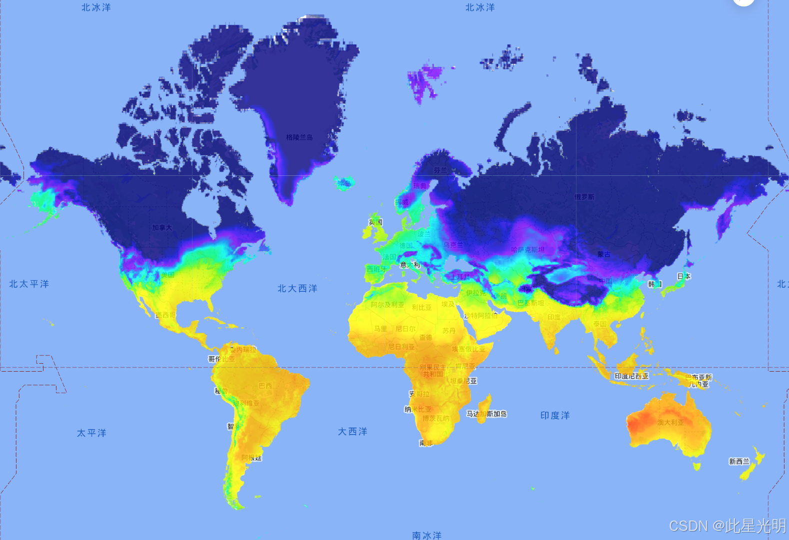
var dataset = ee.ImageCollection('ECMWF/ERA5_LAND/DAILY_AGGR').first();

var visualization = {
  bands: ['temperature_2m'],
  min: 250,
  max: 320,
  palette: [
    '000080', '0000d9', '4000ff', '8000ff', '0080ff', '00ffff',
    '00ff80', '80ff00', 'daff00', 'ffff00', 'fff500', 'ffda00',
    'ffb000', 'ffa400', 'ff4f00', 'ff2500', 'ff0a00', 'ff00ff',
  ]
};
Map.setCenter(70, 45, 3);
Map.addLayer(
    dataset, visualization, 'Air temperature (K) at 2m height', true, 0.8);
кодовая ссылка
результат
Цитировать
Muñoz Sabater, J., (2019): ERA5-Land monthly averaged data from 1981 to present. Copernicus Climate Change Service (C3S) Climate Data Store (CDS). (<date of access>), doi:10.24381/cds.68d2bb30
лицензия
Пожалуйста, следуйте за Коперником C3S/CAMS Положения Лицензионного соглашения, подтверждающего ERA5-Land Использование: 5.1.1 Когда продукт Copernicus сообщается или распространяется среди общественности Получателем, Получатель должен информировать получателей о его источнике, используя следующее или любое подобное уведомление: «Создано с использованием информации Службы изменения климата Коперника [год]». 2 Когда Лицензиат производит или помогает в производстве или распространении публикации, содержащей адаптированный или модифицированный продукт Copernicus, Лицензиат должен предоставить следующее или любое подобное уведомление: «Услуги Copernicus по изменению климата, содержащие изменения». Информация [Год]» Любая такая публикация или распространение, упомянутые в Статьях 5.1.1 и 5.1.2, должны содержать заявление о том, что ни Европейская Комиссия, ни ЕЦСПП не принимают на себя ответственность за содержащуюся в ней информацию Коперника или за любое ее использование.

Неразрушающее увеличение изображений одним щелчком мыши, чтобы сделать их более четкими артефактами искусственного интеллекта, включая руководства по установке и использованию.

Копикодер: этот инструмент отлично работает с Cursor, Bolt и V0! Предоставьте более качественные подсказки для разработки интерфейса (создание навигационного веб-сайта с использованием искусственного интеллекта).

Новый бесплатный RooCline превосходит Cline v3.1? ! Быстрее, умнее и лучше вилка Cline! (Независимое программирование AI, порог 0)

Разработав более 10 проектов с помощью Cursor, я собрал 10 примеров и 60 подсказок.
Я потратил 72 часа на изучение курсорных агентов, и вот неоспоримые факты, которыми я должен поделиться!
Идеальная интеграция Cursor и DeepSeek API

DeepSeek V3 снижает затраты на обучение больших моделей
Артефакт, увеличивающий количество очков: на основе улучшения характеристик препятствия малым целям Yolov8 (SEAM, MultiSEAM).

DeepSeek V3 раскручивался уже три дня. Сегодня я попробовал самопровозглашенную модель «ChatGPT».

Open Devin — инженер-программист искусственного интеллекта с открытым исходным кодом, который меньше программирует и больше создает.
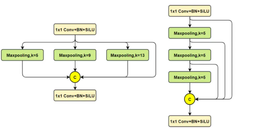
Эксклюзивное оригинальное улучшение YOLOv8: собственная разработка SPPF | SPPF сочетается с воспринимаемой большой сверткой ядра UniRepLK, а свертка с большим ядром + без расширения улучшает восприимчивое поле

Популярное и подробное объяснение DeepSeek-V3: от его появления до преимуществ и сравнения с GPT-4o.

9 основных словесных инструкций по доработке академических работ с помощью ChatGPT, эффективных и практичных, которые стоит собрать

Вызовите deepseek в vscode для реализации программирования с помощью искусственного интеллекта.

Познакомьтесь с принципами сверточных нейронных сетей (CNN) в одной статье (суперподробно)

50,3 тыс. звезд! Immich: автономное решение для резервного копирования фотографий и видео, которое экономит деньги и избавляет от беспокойства.

Cloud Native|Практика: установка Dashbaord для K8s, графика неплохая

Краткий обзор статьи — использование синтетических данных при обучении больших моделей и оптимизации производительности

MiniPerplx: новая поисковая система искусственного интеллекта с открытым исходным кодом, спонсируемая xAI и Vercel.

Конструкция сервиса Synology Drive сочетает проникновение в интрасеть и синхронизацию папок заметок Obsidian в облаке.
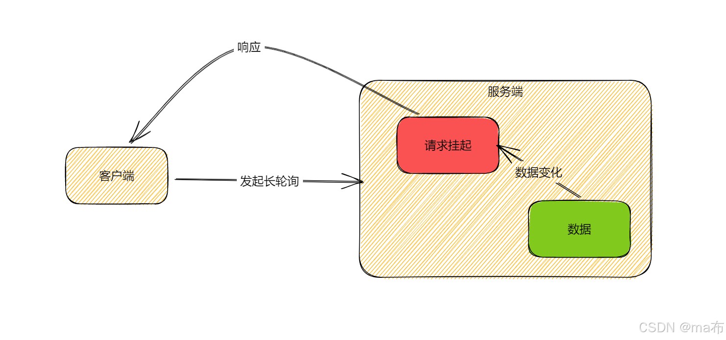
Центр конфигурации————Накос

Начинаем с нуля при разработке в облаке Copilot: начать разработку с минимальным использованием кода стало проще

[Серия Docker] Docker создает мультиплатформенные образы: практика архитектуры Arm64

Обновление новых возможностей coze | Я использовал coze для создания апплета помощника по исправлению домашних заданий по математике

Советы по развертыванию Nginx: практическое создание статических веб-сайтов на облачных серверах
Feiniu fnos использует Docker для развертывания личного блокнота Notepad

Сверточная нейронная сеть VGG реализует классификацию изображений Cifar10 — практический опыт Pytorch
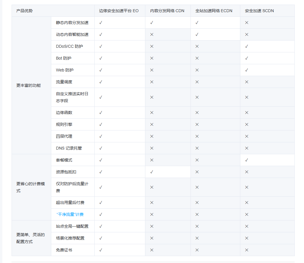
Начало работы с EdgeonePages — новым недорогим решением для хостинга веб-сайтов

[Зона легкого облачного игрового сервера] Управление игровыми архивами
